Categories
Export Flying photography Photography Technology UAS

From above – von oben

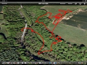
Since a while I am doing aerial photography.

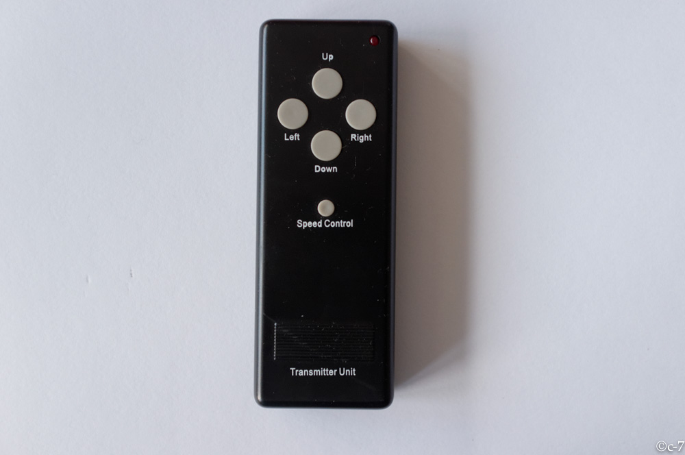
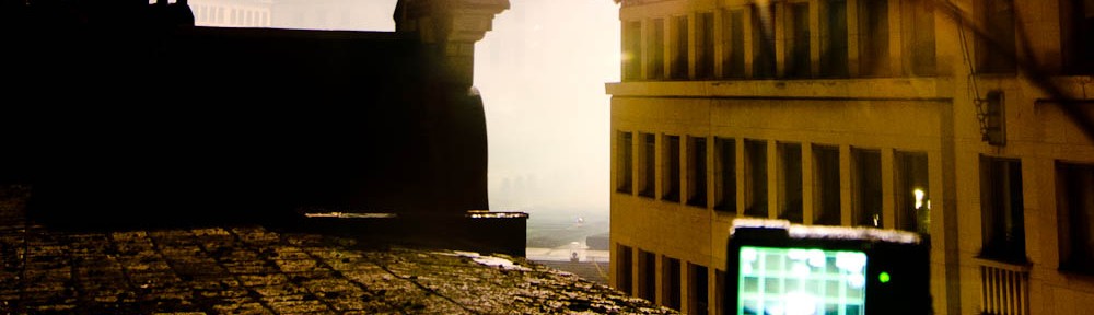
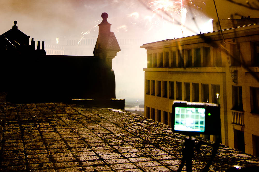
On the flying platform, I use mostly an modified Canon S90 to take picture up to altitudes of around 100 Meter. The Camera is stabilized and shutter release, tilt and pan can remotely controlled. The ‘camera view’ is downstreamed via an 5 GHz video link and displayed on a battery powered control monitor.

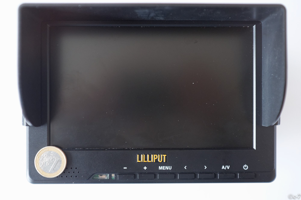
Video / HDMI control monitor.

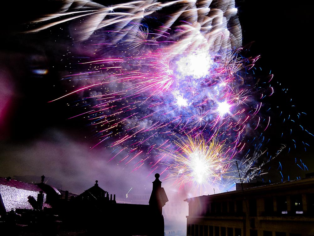
However, sometimes it is not necessary to get as high as 100 Meter. A few meter are sometimes sufficient to overlook a crowd or a wedding audience.

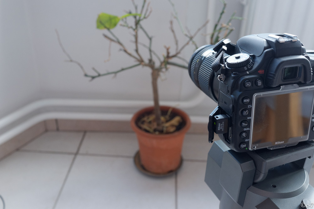
But for those occasions, I prefer to use the DSLR. With an monopod to hold the camera up and to release the shutter with the remote-control wireless or per wire works quite well in many situations. Except, that it is ‘guess-work’ if you don’t want to mess around with the control monitor and the cables. And you can’t control more tan the shutter release.

There are also nice options for tethered shooting with the NIKON DSLRs. Sofortbild is a very nice – and free – application if you have an MAC. It controls the camera via the USB port. However, you need an laptop to use the software, there is no iPad or iPhone version available. Another thing to carry and to handle. Not suitable at all occasions.

Since a while, Nikon has wireless adapters for the DSLRs but they are very expensive.

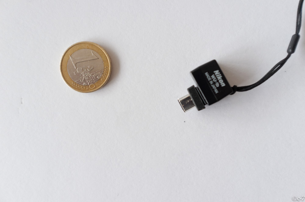
Recently Nikon released the WU-1b which can provide a cheap (50€) solution for remote shooting. It connects to the USB port of the camera.


It is a small dongle.


It provides wireless-hotspot like functionality. After installing the App to you Apple or Android smart device,  connect to the wifi hotspot.

the last leave


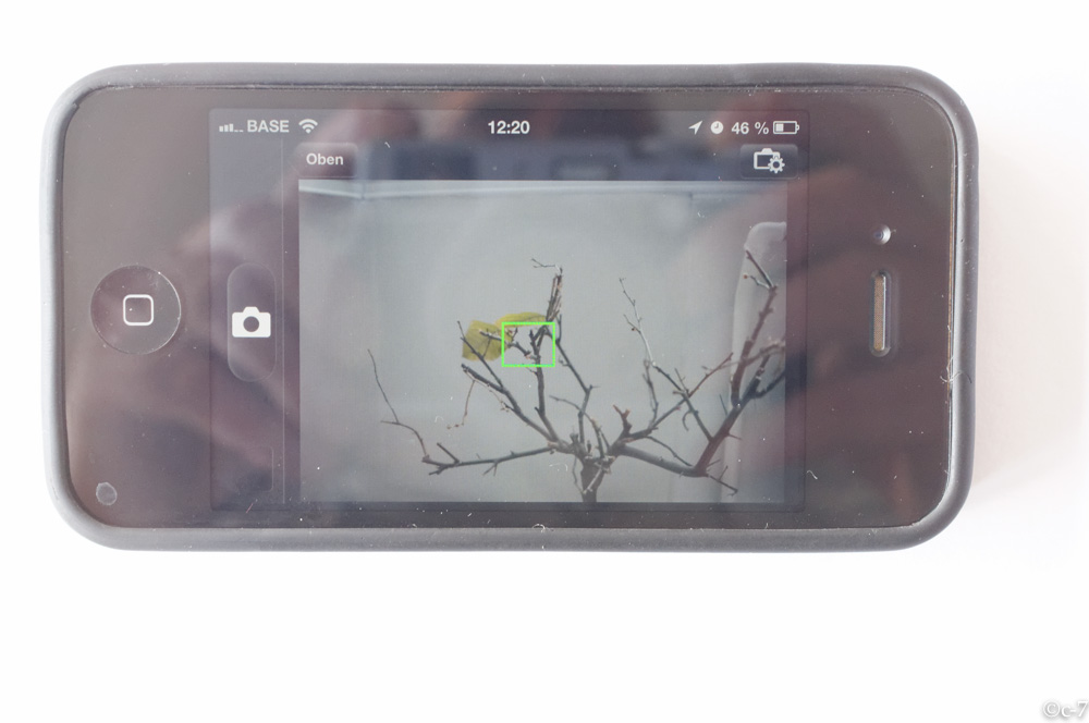
You will be able to see the live view picture, set the focus point and release the shutter and – optionally download the pictures directly to your smart device (I don’t recommend this – time consuming).


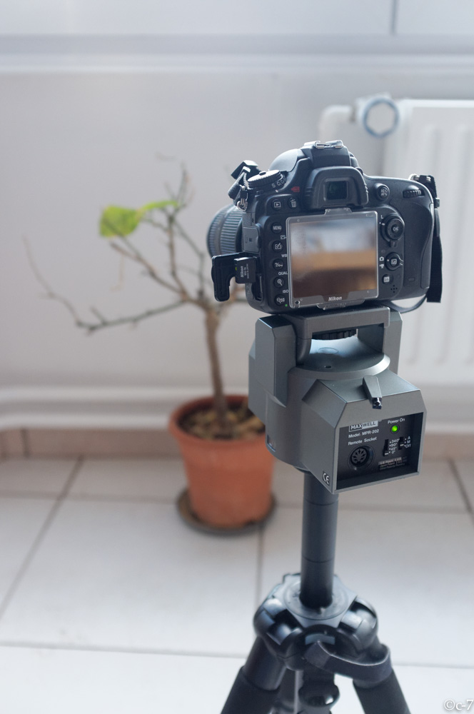
You also may use a pan – tilt head to control the direction in which you camera points. Cool for concerts or sports events. You can place the camera before the event and control it remotely.

DON’T FORGET TO SECURE THE NETWORK 😉


Categories
Photography Technology

New Year 2012-2013 Brussels Firework Photographies – the making-of

The making-of
We are already at the second day of 2013. After I posted a few of the firework pictures to facebook, I’ve got some questions how those pictures were done.
Here is a short making-of.


The plan
I’ve planned to take nice pictures of the firework but and not to spend the first minutes of the year behind the camera and to have a nice Yew Years party.

Automatic shooting
All the pictures were taken automatically while I was enjoying a nice glass of champagne, watching the fireworks and party.

The smallest camera did all the work
Even I carried a lot of gear (those who know me, know the story) to the friends place where we had this nice view, the most impressive pictures came from the Canon Power Shot S90, not from the Fujiifim  X100 nor the Nikon D300. The Canon S90 is very similar to the G9 but is lighter, has less controls and no optical viewfinder. Even after surviving some minutes underwater in a river in Thailand, my G9 died recently its final death after an plane crash – that’s why I took the S90.


Tell me your secrets
I’ve put S90 on a small tripod (normally I don’t recommend those, but in this case it was ok), set ISO to 200, f7.2 and 5 seconds exposure and started the motion-detection / lightning detection script.
Motion-detection / lightning detection script – what the heck?
Since a few years, there is an modified software available for the Canon Power Shot cameras. It is some kind of ‘un-official’ and not supported by Canon. It installs on a memory card (which can be a bit tricky) but really worthwhile the effort.
It provides a lot of interesting features, like pre-defined functions for bracketing or specific RAW settings but also the possibility to create user defined scripts, accessing the camera functions and much more.
You find more details here: http://chdk.wikia.com/wiki/CHDK 

As mentioned before, the setup was ISO to 200, f7.2 and 5 seconds exposure, RAW format and using the fast lightning / motion-detection script. This scripts releases the shutter each time something significant happens in the view of the camera. Even you can set different thresholds or specific areas, I left it with the defaults.

Go and take the pictures, I’ll have a drink
The firework lasted 20 minutes. The Canon S90 took automatically roughly 60 pictures with a “good” rate of nearly 50% and a “woow” rate of maybe 15%-20% (I stayed with the default set-up).
In the meanwhile I had at least three glasses of Champagne and plenty of “Happy New Year Kisses”.

What came after
There was minimal post-processing, mostly limited to little contrast enhancements  and cropping.

Happy New Year 2013!!!

If you are interested to learn more about photography, share knowledge and meet other people interested in photography in an relaxed way, check-out http://www.meetup.com/Brussels-Photography/ and join the group or leave your reply for specific questions.


Categories
Flying Photography Technology Things UAS

UAS-Model (UAS-M) recovered after loss of control and subsequent crash

BäumeI am using a small Unmanned Aerial System Model (UAS-M) for Aerial Photography. The world looks different from above. Carrying a modified Canon allows automatic serial capture of images. The first test flight with the new folding frame was successful. The flight behaviour was excellent and the system would become back-pack transportable. A load test and camera flight was conducted after this initial test. After approx. 5 minutes of flight, height ca. 50 meter AGL, distance 100 meter control was lost. Several attempts were made to re-gain control but neither manual nor GPS controlled coming home did work. The platform kept hoovering slowly away. Hight control did still work but the platform was over a corn field and at this point in time an emergency landing in the field seemed not to be a viable option. However, instead following it on the ground, time was wasted with attempts to re-gain control. The platform kept moving away towards a wooded valley and sight was lost approx. 20 minutes after take off at a distance of ca. 800 meter.
The valley is covered by a dense forest with some meadows, a abandoned rail-road and a little river. A small road with not much traffic (5-10 vehicles / hour) leads through it.

During crash
automatically taken during decent/crash

When the sight to the UAS-model was lost, the actual position could only very roughly estimated. The tolerance could be a a couple of hundred meter in either direction with high trees, water and a steep hill. Furthermore it was nor clear if it came down immediately or kept flying for some minutes more.
At this time the chance to recover the UAS-model was close to zero. Neither the 5GHz video link nor the autonomous GPS/GSM tracking device, which could have reported the actual position through a telephone call/SMS were installed.
Dense woods and even a small river in the valley.
Nevertheless, we had to do ‘something’ and started the search by driving through the valley by car. Already after five minutes we were lucky to pick-up the signal from the telemetry downlink! We interpolated the closest distance / strongest signal by driving up and down the road and finding the mid-point between the points where the signal was getting weaker and got finally lost. Now we were again optimistic and – while stopping the car at the estimated closest point to the crash-zone of the UAS-M we already thought about some strategies for a systematic search considering the time left for battery power for the telemetry and also getting the ropes for recovering it from a tree.
Recovery
What than happened was a real surprise. While getting out of the car, we switched off the remote control. This forces (if not damaged) the UAS-M to switch on the loss-of-signal-warning beeper. And this was exactly what happened. We could hear the sound! The UAS-M had come down just two meter beside the road in the grass! Not on the road and not in the trees nearby! A almost perfect landing. Only damage: one broken boom!

recovery
recovery. It went down three meter beside the road

Analysis
The post incident analysis showed the following: The rubber-studs on which the electronic components are mounted, failed and the complete electronics module with GPS, giros and accelerometer dis-integrated from the frame, leaving the module only connected by the electric wires to the battery and motors. Surprisingly this did not lead to an immediate crash. The UAS-model drifted out of range, the “GPS coming home on signal loss” did not work probably because the electronics part was freely moving. However, the height control was not affected, the platform stayed, controlled by barometric pressure, at the same flight level (over the valley at about 90m AGL) until the main power was insufficient to keep the UAS-M airborne.

damage

20120812-015503.jpg